Archambault’s Post
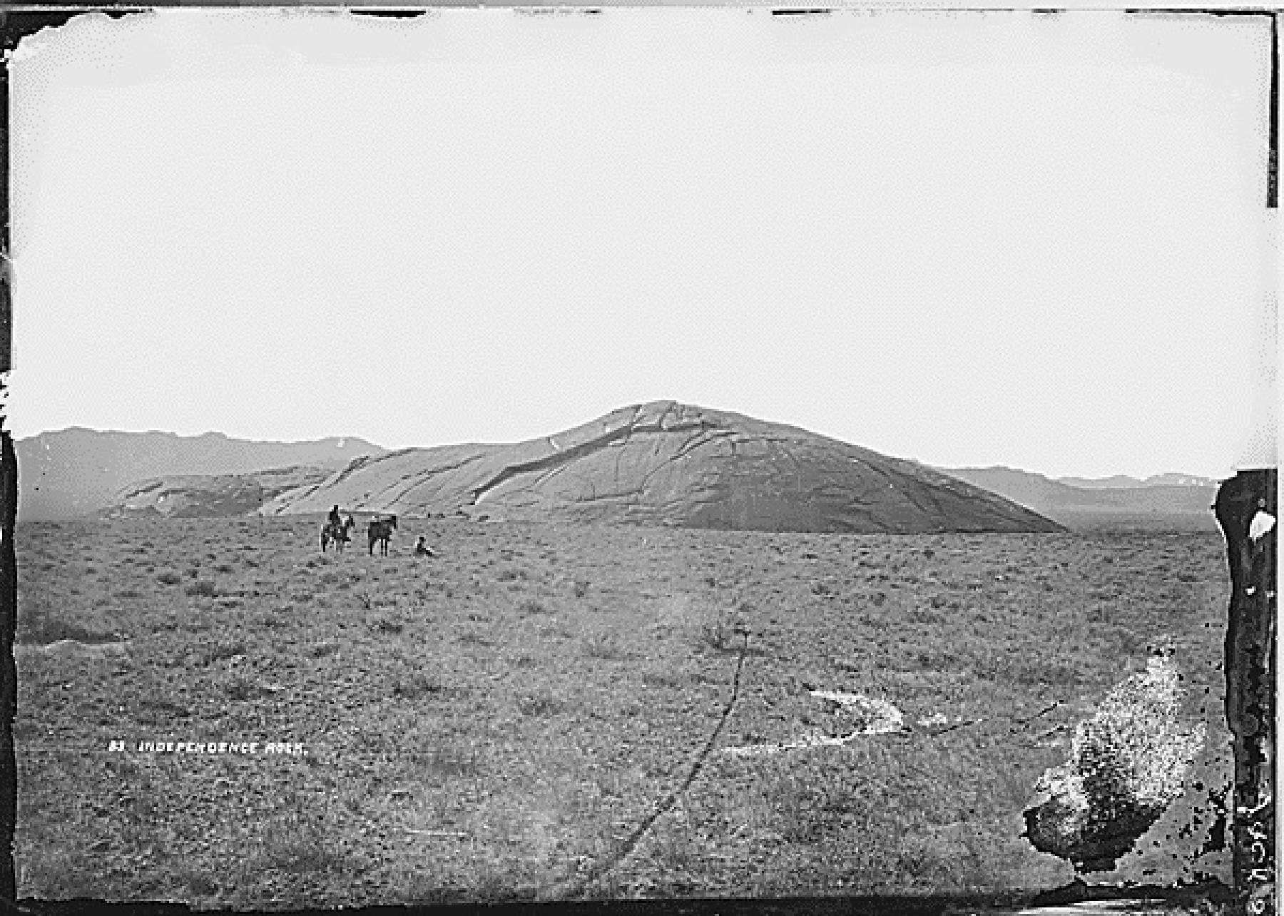
Archambault’s Post was a trading post established in 1853 near Independence Rock along the Sweetwater River in present-day Natrona County, Wyoming. Its history has been the source of considerable confusion, owing to the complex ownership of the post and the wide-ranging activities of its principal operator in the region during the preceding decade.
Origins and Construction
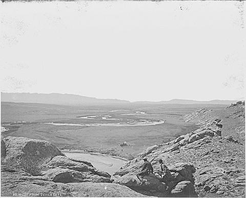
The post grew directly out of the Seminoe venture, a trading compound established the previous year at Devil’s Gate on the Sweetwater River. Seminoe’s Post took its name from Charles Lajeunesse, who was commonly called “Little Simon” or “Simono,” a nickname that became “Seminoe.”1 August Archambault, along with his brother and several other individuals, were partners in that earlier enterprise.2 In 1853, the same partnership constructed a bridge on the Sweetwater River, located some seven miles from Seminoe’s Post.3 It quickly became apparent that operating a post and a bridge so far apart was impractical, as it required splitting the workforce between two locations. Rather than abandon Seminoe’s Post at Devil’s Gate, the partners built a new facility near the bridge. That new facility became Archambault’s Post.
Though less elaborate than Seminoe’s Post and offering less shelter, Archambault’s Post began to outpace Seminoe’s in trade, primarily because its location was further east along the emigrant trail. In time, the site became known as Sweetwater Station, likely because a stage station was subsequently placed nearby.4
Names, Ownership, and Partners
Emigrant accounts often referred to the post as “Shambro’s,” almost certainly a phonetic rendering of Archambault’s name.5 Other contemporary records document the partnership between Seminoe, Archambault, and a number of other Canadians in more precise terms.6 These sources confirm that when the post was first built, it was jointly owned and operated. Sometime between 1853 and the post’s abandonment in 1856, sole ownership passed to Archambault, though the exact year that transition occurred is not known.7
August Archambault in the Region Before 1853
Some contemporaries placed Archambault in the Devil’s Gate area constructing a trading post as early as 1846, which has contributed to uncertainty about the post’s founding date. Archambault and a number of other French Canadian trappers had been operating out of the Green River country as early as 1843, associated in some capacity with the Bridger and Seminoe interests in the area.8 By the mid-1840s, those Green River trappers recognized the commercial potential of the summer emigrant traffic along the Sweetwater, and large trading parties would move into the region seasonally, erecting temporary hide lodges and conducting trade from wagons.9 There is, however, no evidence that Archambault established a permanent trading post on the Sweetwater near Devil’s Gate or Independence Rock before 1852. The confusion appears to stem from his seasonal, open-air trading activities during the 1840s while he was still based out of the Green River region.
Abandonment and Forced Departure
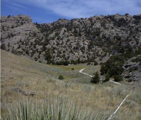
Operations at the post continued until 1856, when declining emigrant traffic and rising tensions with Native American groups led to its abandonment.10 The precise date of the initial closure is not recorded, though accounts indicate the area had been vacated by July of that year.11 That fall, two late-starting companies of Mormon handcart emigrants arrived during a terrible snowstorm to find the post abandoned. The later company, led by Edward Martin, stopped at the post and burned part of it for warmth, with some taking shelter for about a week at a cove in the rocks a mile or so upstream, a place that later became known as Martin’s Cove.12
Archambault made two attempts to return. In September 1856, he tried to re-occupy the post but was driven off by Sioux, who shot his cattle, ran off a number of his horses, and left an arrow in the post door as a warning. The following spring, in 1857, he tried again, and was again forced to abandon the site, this time permanently.13
Confusion with Other Posts
Several historical sources have claimed the post was subsequently re-occupied by either Gilbert and Garrish or by Louis Guinard.14 These attributions do not hold up to scrutiny. Archambault’s Post sits a little over a mile below Devil’s Gate, while Guinard’s Sweetwater Station is located more than six miles northeast of Devil’s Gate, and Gilbert Station is over sixty miles away. Though Archambault’s location is closer to Seminoe’s than the seven miles estimated by contemporaries, it is still the most geographically appropriate candidate. Guinard’s Post lies east of Devil’s Gate rather than west, as Seminoe’s did, and Gilbert Station is far too distant to have been managed in connection with Seminoe’s Post. Viewed across the open nineteenth-century Wyoming landscape, these three posts may have seemed to occupy a single general area, but they represent three distinct properties at three distinct locations.
What Remains Unknown
The exact location of the battle and any associated structures has, as yet, not been verified, and basic questions about any post—its size, layout, and construction—remain unanswered. If remains are ever found, the site could shed light on trade between the Shoshone and American traders, the daily lives of independent post operators, and the final years of the Rocky Mountain fur trade.15
[Editor’s Note: Special thanks to the author and to the Wyoming State Historic Preservation Office for making this article available, and to the Wyoming Cultural Trust Fund for its ongoing support for this project. Greg Pierce’s historical monograph, Negotiating the West: A History of Wyoming Trading Posts, from which this article is adapted and excerpted, is one of many historic contexts published by the Wyoming State Historic Preservation Office. These documents are meant to offer a broad background against which historic developments can be better understood as the agency works to preserve properties and places important to an understanding of Wyoming’s past. The contexts also, however, are based on sound research and are full of well-told, vivid stories. With this in mind, WyoHistory.org is collaborating with the SHPO office to bring more of this history to a wider readership. The Cultural Trust has provided the funds to make this collaboration possible. We offer our thanks to all.]
Footnotes
-
“Seminoe vs. Seminole,” Annals of Wyoming 6, no. 2 (1929), 237; William Marshall Anderson, The Rocky Mountain Journals of William Marshall Anderson, ed. Dale L. Morgan and Eleanor Towles Harris (Lincoln: University of Nebraska Press, 1987), 334; David Lavender, Fort Laramie and the Changing Frontier, National Park Service Handbook 118 (Washington, DC: Division of Publications, National Park Service, 1972), 6; Danny N. Walker, Archeological Investigations at Seminoe’s Trading Post, 48NA288, Natrona County, Wyoming, prepared for the Wyoming State Historic Preservation Office (Laramie: Wyoming State Historic Preservation Office, 2009), 1.
-
Lodisa Frizzell, quoted in Kenneth L. Holmes, ed., Covered Wagon Women, Vol. 4: Diaries and Letters from the Western Trails, 1852 (Lincoln: University of Nebraska Press, 1997), 53; Walker, Archeological Investigations, 21.
-
Magloire Alexis Mousseau, interview by Judge Eli S. Ricker, Buzzard Basin, Pine Ridge Indian Reservation, South Dakota, October 30, 1906, Nebraska State Historical Society, Lincoln, Nebraska, 16–17.
-
“Historic Document Tells Early Day Drama of West,” Annals of Wyoming 15, no. 3 (1943), 229–233; Ruth Beebe, Reminiscing Along the Sweetwater (Boulder: Johnson Publishing Co., 1973), 18; LeRoy R. Hafen and Francis Marion Young, Fort Laramie and the Pageant of the West (Glendale: The Arthur H. Clark Company, 1938), 234; Mousseau, interview, 16–17; John M. Townley, The Overland Stage (Reno: Great Basin Studies Center, Jamison Station Press, 1994), 4; Walker, Archeological Investigations, 24.
-
Walker, Archeological Investigations, 21.
-
Mousseau, interview, 16, 20.
-
Robert A. Murray, “Trading Posts, Forts, and Bridges of the Casper Area: Unraveling the Tangle on the Upper Platte,” Annals of Wyoming 47, no. 1 (1975), 13.
-
J. Cecil Alter, Jim Bridger (Norman: University of Oklahoma Press, 1962), 251, 253, 254, 205–212; Dale L. Morgan and Eleanor Towles Harris, in Anderson, Rocky Mountain Journals, 334.
-
Johnston, quoted in Alter, Jim Bridger, 232.
-
Murray, “Trading Posts,” 13.
-
Andrew Galloway, “A Brief Record of the First Handcart Company,” Utah Genealogical and Historical Magazine 18 (1927), 54; LeRoy R. Hafen and Ann W. Hafen, To the Rockies and Oregon, 1839–1842 (Glendale: Arthur H. Clark Company, 1955), 211.
-
Wyoming State Historic Preservation Office, “Devil’s Gate,” WyoHistory.org, January 2, 2015, https://www.wyohistory.org/encyclopedia/devils-gate.
-
“Historic Document Tells Early Day Drama of West,” 231; J. R. Brown, unpublished diary, microfilm copy, Bancroft Library, University of California, Berkeley, n.d.; Beebe, Reminiscing Along the Sweetwater, 18; Aubrey L. Haines, Historic Sites along the Oregon Trail (Gerald, Missouri: The Patrice Press, 1981), 196–197.
-
Beebe, Reminiscing Along the Sweetwater, 18; Haines, Historic Sites, 196–197; Mark Junge, “Last or Ninth Crossing, Gilbert’s Station, South Pass Station, Burnt Ranch,” National Register of Historic Places Inventory—Nomination Form (Washington, DC: National Park Service, 1976), 35.
-
Greg Pierce, Trading Posts in Wyoming, Multiple Property Documentation Form, National Register of Historic Places, Wyoming State Historic Preservation Office, State Parks and Cultural Resources, Cheyenne, Wyoming, 2012, Section E, 64.