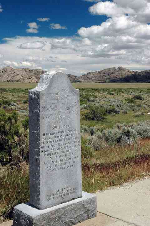
Split Rock
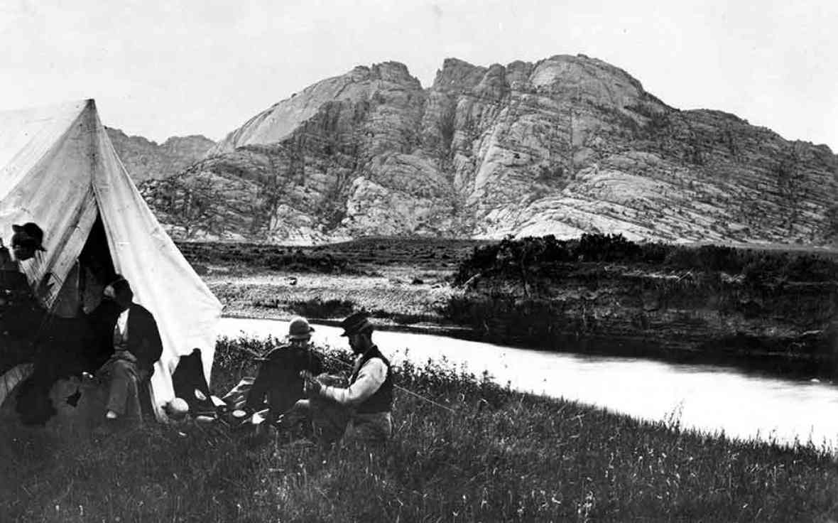
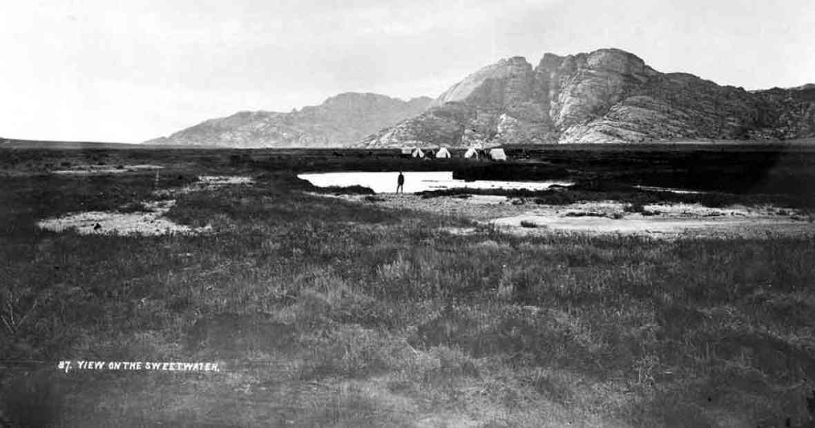
The Sweetwater Valley contains three distinctive granite landmarks: Independence Rock, Devil’s Gate and Split Rock. The last of these, Split Rock, with its unforgettable gunsight notch, was visible to emigrants for two days or more as they approached and then left it behind them.
Some emigrants on the Oregon, California and Mormon trails—all one road at this point—found this landmark in the Rattlesnake Range a useful navigational tool as they made their way west up the Sweetwater. “[Y]esterday,” Joseph Middleton wrote in 1849, “from the time we started we steered to this cliff with a steadiness that was astonishing, never deviating from it more than the needle does from the north pole, excepting once for a short time—I think this cleft or rent or chasm is very conspicuously seen from the Devil’s Gate, which I think is 11 miles from here; and I think it is still at least 6 or 8 miles ahead. …”
Rising some 1,000 feet above the sagebrush prairie, Split Rock aimed westbound emigrants directly at South Pass, still more than 75 miles away. The relatively gentle landscape offered them a short, but much needed, respite in their long journey.
Emigrants were struck by the rock’s beauty, too. “The picture was worthy the pencil of an artist,” William Carter wrote late in 1857. “Our camp was near what is called the Split in the Rock, a remarkable cleft in the top of the mountain which can be seen at a great distance in either direction.”
Split Rock Station is located a short distance west of Split Rock between Cranner Rock and the south bank of the Sweetwater River in what is now a hay meadow. In the early 1860s, the site served as a Pony Express station, stage station and telegraph station.
Diarist Henry Herr reported that, in 1862, 50 soldiers from the 6th Ohio Regiment were encamped here to protect the emigrants. A crude log structure and pole corral that were part of the station are now part of a private ranch homesite.
Editors’ note: This article is an expanded version of one originally commissioned by the Wyoming State Historic Preservation Office for a website on the Oregon, California, Mormon Pioneer and Pony Express trails across Wyoming. Recycled here with thanks.
Resources
- Carter, William. Diary. Annals of Wyoming, Vol. 11, No. 2, 1939, p. 103, accessed Jan. 13, 2015, at https://archive.org/stream/annalsofwyom11141939wyom#page/102/mode/2up.
- Herr, Henry R. Diary, 1862, typescript excerpt. Portland: Oregon State Historical Society, manuscript 1508.
- Middleton, Joseph. The Diary and Letters of Dr. Joseph Middleton, typed transcript. MSS S-39, Beinecke Library, Yale University.
For further reading and research
- Brown, Randy. Historic Inscriptions on Western Emigrant Trails. Independence, Mo.: Oregon-California Trails Association, 2004, pp. 217-221. Details pioneer inscriptions on rocks in the vicinity of Split Rock.
- Rea, Tom. Devil’s Gate: Owning the Land, Owning the Story. Norman, Okla.: University of Oklahoma Press, 2006. A detailed history of the Sweetwater Valley.
Illustrations
- The 1870 William Henry Jackson photos of Split Rock with members of the Hayden Survey are courtesy of the U.S. Geological Survey. Used with thanks. The lower image is damaged slightly in the lower left-hand corner. As of early 2015, the old USGS photo library website is down; to find historic USGS photos until it is repaired, try the "Advanced Search" link at https://www.sciencebase.gov/catalog/.
- The color photo of a distant Split Rock with the historical marker in the foreground is by Richard Collier of the Wyoming State Historic Preservation Office, one of many he took for SHPO's website on the historic trails. Used with permission and thanks.